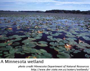
The extensive freshwater wetlands of the Great Lakes' coasts are unique in ecological character, size and variety. They range from small wetlands nestled in scattered bays to extensive shoreline wetlands such as those of southwestern Lake Erie, freshwater estuaries such as the Kakagon Sloughs of northern Wisconsin and the enormous freshwater delta marshes of the St. Clair River.
What is a wetland?
Wetlands are areas that are not dry land and not open water - they're a little bit of both. Found between the areas of dry land and open water, they include marshes, swamps, bogs, fens and barrier beach wetlands. Differing from inland lakes, wetlands are shaped and influenced by waves, seiches, and lake level fluctuations. Wetlands are one of the most productive ecosystems in the world, being home to many rare species. The U.S. Fish and Wildlife Service estimates that 43 percent of all threatened and endangered species rely on wetlands for their survival. Wetlands are an important part of the migratory cycle, providing food, resting stops and habitats for many migratory birds, such as ducks and geese. Wetlands also improve water quality by slowing surface runoff, and processing organic waste and sediments before they reach open water, thus protecting aquatic life and sources of drinking water. Flooding is also controlled with the help of wetlands. Wetlands will store water during times of flood or high lake levels, and then will slowly release the water during times of drought or low lake levels.
How were the Great Lakes' wetlands created?
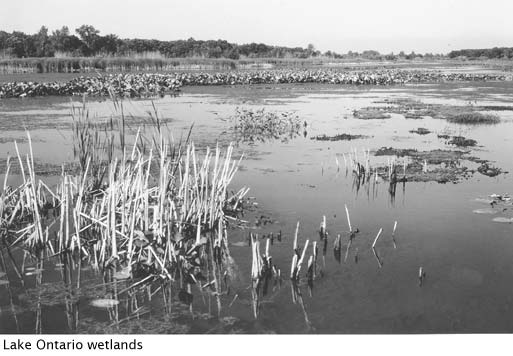
Glaciers helped to create wetlands in the Great Lakes region around 12,000 years ago. Large wetlands formed when glaciers dammed rivers and created valleys. Large blocks of ice left behind by receding glaciers also created smaller wetlands by forming pits and depressions in the land.
Erosion and deposition of sediment on adjacent lands during floods can also create wetlands along rivers and streams. Periodic flooding provides the moisture needed to sustain the wetland, and they undergo constant change and transformation.
What are some threats to wetlands?
Wetlands were once considered wasted land that would be of better use if they were drained, filled, and used for agriculture or development. Although we have recently begun to recognize the significance and importance of wetlands, the United States and Canada have been destroying wetlands for the past 200 years. Consequently, more than two-thirds of the natural Great Lakes wetlands have already been filled in or drained for agriculture, urban uses, shoreline development and recreation. For example, 83 percent of western Lake Ontario's marshes have been filled in and lost to urbanization. Shoreline modification to prevent erosion and flooding, such as dikes and revetments (seawalls), have also threatened wetlands by affecting lake level fluctuations and sediment nourishment.
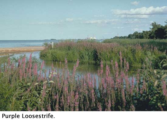
Non-native invasive plant and animal species can also hurt wetlands. These species can choke out native plant species, thus reducing habitat diversity and the health of the wetland ecosystem. Purple loosestrife, Eurasian watermilfoil, and zebra mussels are all examples of non-native species that affect wetlands.
Isle Royale
Located in the northwestern section of Lake Superior, the archipelago of Isle Royale National Park is a reminder of what primitive America's landscape looked like. Both molten lava and glaciers shaped the shorelines and inland lands, and created a landscape unique to Isle Royale.
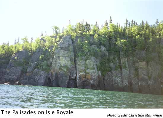
Over one billion years ago, the earth's crust cracked in what is now the area of Lake Superior, and molten lava poured out onto the land. Exploding over 100 times, lava spouted from the cracks in the earth, coating the earth with layer upon layer of lava; the weight of the lava eventually sunk the land and formed the Lake Superior basin. Some of the lava flows in this region, like the Greenstone Flow, are among the largest and thickest flows in the world. They took tens of hundreds of years to cool and solidify, and in doing so formed the giant columns of the Palisades.
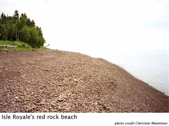
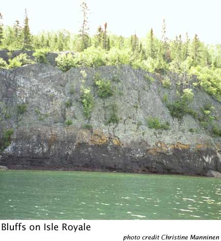
Isle Royale's southern and northern shorelines differ greatly. About 11,000 years ago, the last glacier starting retreating from Isle Royale. There was a pause in the glacial retreat when the glacial ice front lay across the southwest end of Isle Royale; after that long pause, the ice rapidly retreated across the rest of the island, leaving a thin mantle of deposits at the southwest end, but very little material on the central and northeast sections, where the ice melted quickly. Today, you can see the result of this glacial retreat by comparing the beaches of the south shore (photo above) with the north shore (photo at right). The southernmost beaches are composed of reddish sedimentary rocks deposited during the long pause of the last glacier, while the northernmost tip of Isle Royale is composed of rocky bluffs.