
by Skylar L. Primm
During the Ice Age, mile-thick sheets of ice covered the Great Lakes region multiple times depressing the crust with their weight. Ancient beach ridges mark previous lake shorelines. Since glaciers retreated (about 10,000 years ago), Earth’s crust has been adjusting upward in a process of isostatic rebound that continues today.
The most recent Ice Age started around 2.5 million years ago, and continues to this day. However, the most recent glaciation ended roughly 10,000 years ago with the aptly-named Wisconsinan Glaciation. In his book Walking Home Ground: In the Footsteps of Muir, Leopold, and Derleth, Robert Root writes: “When you think of Wisconsin's landscape, you think in terms of either the glacier's presence or its absence.” (142). Indeed, everywhere you look in the Great Lakes region, you can find geological evidence left behind by glaciers. We have the Ice Age to thank for the existence of the Great Lakes themselves and the environmental and economic benefits they provide to the region.
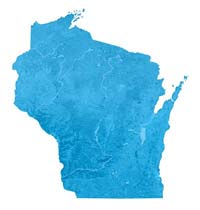
A topographic map of the state of Wisconsin shows clear contrasts between the rough terrain of the southwestern Driftless Area, which was never glaciated, and the relatively flat remainder of the state, which was ground down over the millennia by the relentless motion of miles-thick ice sheets. The ice sheets weighed so much that the entire North American continental plate is still in the process of popping back up, like a piece of styrofoam pushed underwater!