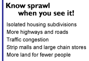
Perhaps you've noticed your community is getting a little bigger. Road construction seems to be everywhere and traffic is heavier than it used to be; new strip malls and "big box" stores are popping up; and land on the outskirts of your town is being cleared for new housing subdivisions. Your community could be experiencing urban sprawl, an issue that has affected cities and towns across the country as well as the Great Lakes region.
Urban sprawl can be generally defined as wide-spread, low-density development that consists primarily of strip commercial developments, such as malls and large office buildings, and housing subdivisions connected by new, wide roads and boulevards. The subdivisions are set apart from other development and built within a specific price range, and people are dependent on their cars to get them from one place to another. With sprawl, fewer people occupy more land and as the people spread out, so do the buildings, roads and houses. Urban sprawl is difficult to define but people usually know it when they see it. The following maps describe what an urban sprawl suburb might look like (left) compared to the land use plan of a town that avoids sprawl (right).
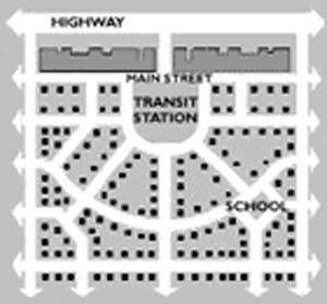
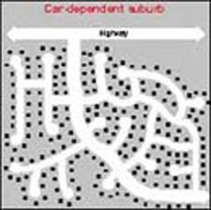
Urban sprawl layout (left) compared to an anti-sprawl urban design (right)
Maps by Gail Dennis, Michigan Land Use Institute
Source: "The Next American Metropolis," by Peter Calthorpe.
The Great Lakes region is losing its rich farmland and other greenfields to urban sprawl at an alarming rate, and the environment and the residents are paying the price. Many cities of the Great Lakes region, such as Chicago, Detroit, Cleveland, are seeing their businesses and residents move to the suburbs, forever destroying open spaces and leaving behind cities of abandoned buildings with fewer taxpayers.