Water levels are measured and recorded at many locations around the Great Lakes and on their connecting channels.
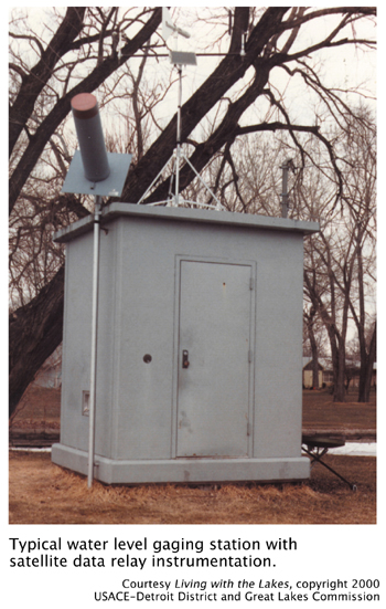
The National Ocean Service of the National Oceanic and Atmospheric Administration (NOAA) presently operates 31 water level gages on the Great Lakes and 18 gages on the connecting channels. In Canada, the Canadian Hydrographic Service maintains 29 water level gages on the Great Lakes and 27 on the St. Lawrence River. Other agencies, including the U.S. Army Corps of Engineers, New York Power Authority and Ontario Power Generation, also operate recording gages at various locations on the lakes.
Great Lakes water levels are officially measured from the International Great Lakes Datum 1985 (IGLD 1985). This datum is referenced to sea level, as measured at Rimouski, Quebec, near the mouth of the St. Lawrence River. Because the crust of the earth in the Great Lakes region is continuously rising with respect to sea level, and the rate of movement is not uniform throughout the region, the IGLD must be updated every 25 to 30 years.
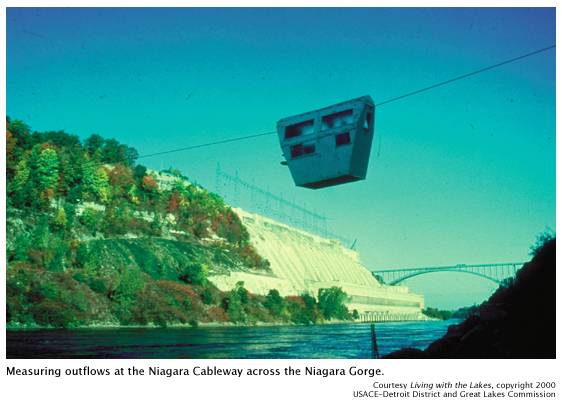
The rate of flow, or discharge, in a river or Great Lakes connecting channel is determined by measuring the channel depth and width, and the velocity of the flow. Measurements can be made by boat, from a bridge, or from a cableway strung across the river. With sufficient measurements of flow over a range of water levels, mathematical relationships can be developed between levels and discharges for various points along the connecting channels and the St. Lawrence River. These equations are essential to the coordination of outflow data, particularly related to hydroelectric power usage of Great Lakes waters.
Effects of lake level fluctuations
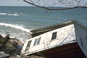
Stretching more than 9,500 miles, the shores of the Great Lakes are constantly reshaped by the effects of wind, waves and moving water. Erosion is a natural process that occurs under all water level conditions, although it is often magnified during periods of high water or storms. In areas of high-density development, minor deviations from long-term average water levels can produce pronounced economic losses. In less developed areas, impacts can be less noticeable.
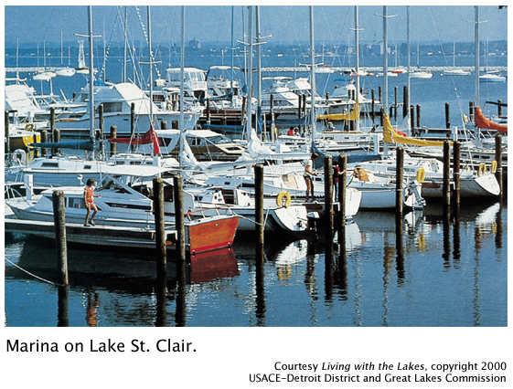
Low levels, too, can have negative impacts on how people use the lakes, ranging from forcing shippers to lighten their loads to causing problems at drinking-water intakes. Boaters must be careful when navigating in non-dredged marinas and other shallow water areas. Boaters should be familiar with and make it a regular practice to use navigation charts for the waters they expect to navigate. These charts are published by the National Oceanic and Atmospheric Administration (NOAA) and Canada's Department of Fisheries and Oceans. When navigating unfamiliar waters, using caution and reducing speeds is advised.
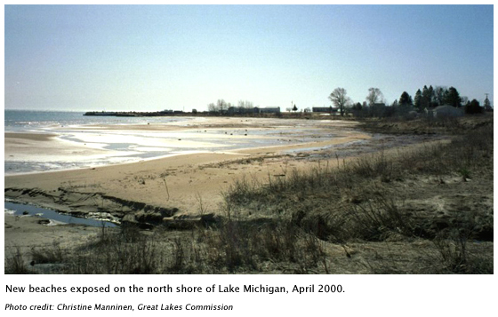
Low water levels have other effects, too. Shoreline property owners enjoy wider beaches, and new vegetation springs up farther from shore, which, in the long run, will provide new habitat for fish when water levels rise again. And while there are new navigation hazards to negotiate, explorers often find reefs, wrecks and old piers they never knew existed until the water fell.
Water levels are only one of the complex physical processes exerted upon our Great Lakes shorelines. Whether you live on one of the Great Lakes or simply enjoy boating or visiting the region's beaches, being aware of water level changes and their potential impacts can save you considerable time, money and worry.